More rain anticipated this week
Heavy Rain and flooding are expected to impact Western Washington through Thursday.
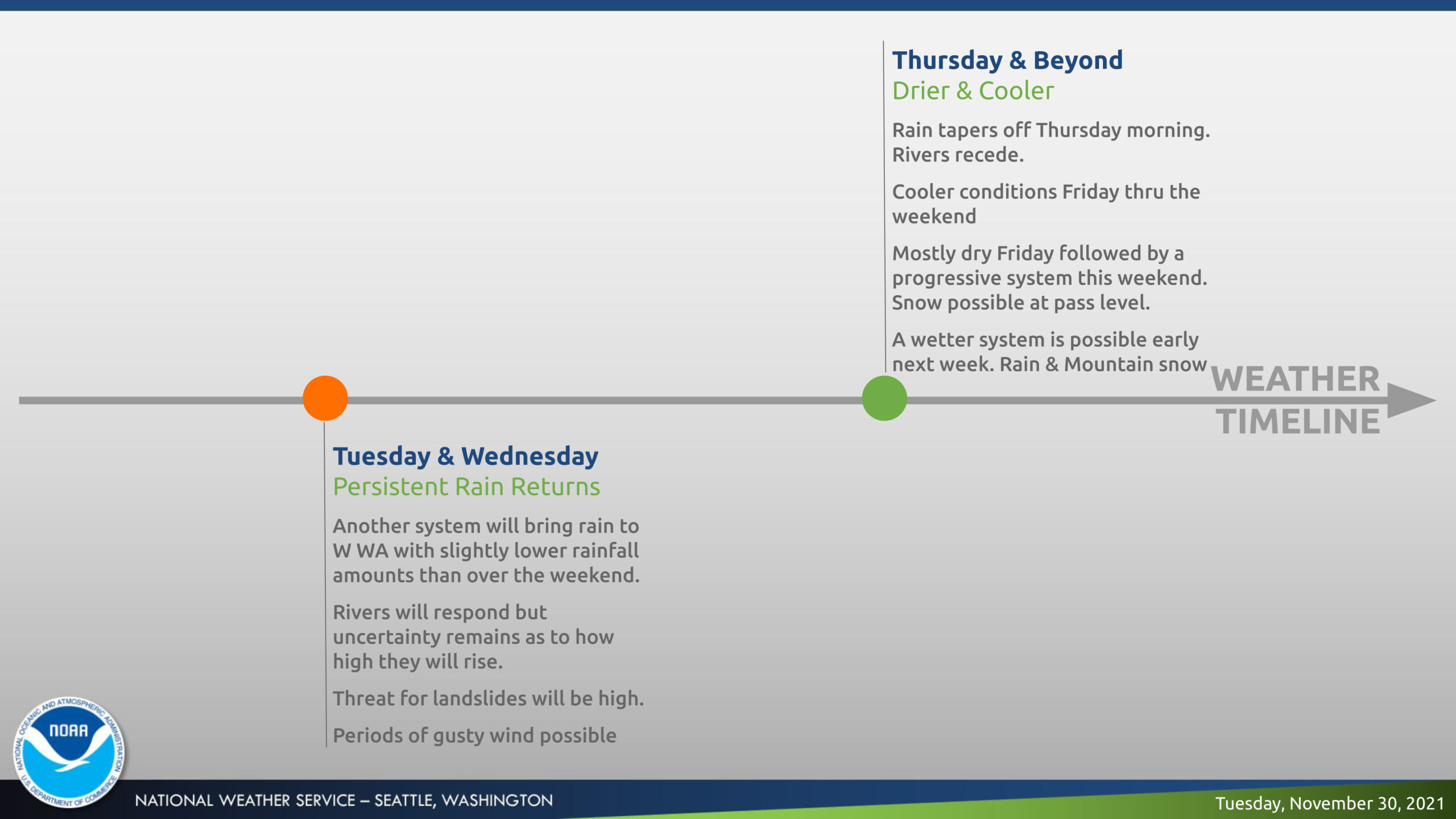
The National Weather Service announced that additional heavy rainfall is expected today through Thursday morning, with the hardest hit areas being on the Olympic Peninsula and across Whatcom and Skagit Counties.

Rainfall totals are expected to be slightly lower than the weekend system, but elevated rivers and saturated ground will cause the risk for flooding to remain.
Heavy rain may lead to flooding in low-lying areas, underpasses, and areas with poor drainage today and Wednesday.
River flooding will lead to minor to moderate inundation of flood-prone areas such as farmland and low-lying roadways.
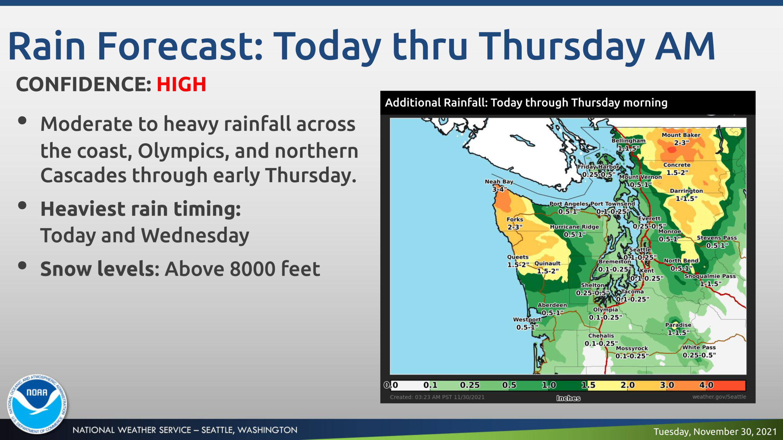
Areas with the highest potential for river flooding include Olympics (Skokomish, Bogachiel Rivers), the Cascades from Snohomish County northward (Nooksack River, Skagit, and potentially the Stillaguamish).
Threat of landslides area wide due to continued unstable soils and additional rainfall.
Gusty winds will be possible once again, although the highest risks locally will be along the coast with wind speeds possible at 30-35 mph.

Rain tapers Thursday morning giving way to relatively drier and cooler weather Friday onward, bringing cooler conditions through the weekend with highs in the 40s and lows in the 30s.
A wetter system looks to approach the region early next week.
You Might Also Like